
Itinéraires Saint-Jean-du-Bleymard
Cliquez sur un itinéraire pour afficher ses statistiques, sa carte et son profil.
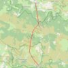
GR70 Étape 1 : Le Bleymard -> Le Pont-de-Montvert
France > Occitanie > Lozère > Mont Lozère et Goulet > Saint-Jean-du-Bleymard
Chemin de Stevenson (GR70) - Étape 1. 19 km | +820 m / -800 m | 5h30-6h.
Distance : 15,2 Km • Dénivelé positif : 996 m • Altitude maximum : 1 686 m

Pont de Montvert - Le Bleymard-Saint Jean du Bleym
France > Occitanie > Lozère > Mont Lozère et Goulet > Saint-Jean-du-Bleymard
Randonnée entre Le Bleymard et Le Pont-de-Montvert. Massif Central. #Randonnée #Lozère #MassifCentral #Montagne #Nature
Distance : 21,2 Km • Dénivelé positif : 748 m • Altitude maximum : 1 701 m

Le Bleymard (La Remise)-Pont de Montvert
France > Occitanie > Lozère > Mont Lozère et Goulet > Saint-Jean-du-Bleymard
Randonnée entre Le Bleymard et Le Pont-de-Montvert. Massif Central. #Randonnée #Lozère #MassifCentral #Montagne #Nature
Distance : 20,5 Km • Dénivelé positif : 699 m • Altitude maximum : 1 702 m

2023-05-19 16:19:45
France > Occitanie > Lozère > Mont Lozère et Goulet > Saint-Jean-du-Bleymard
Distance : 17,3 Km • Dénivelé positif : 678 m • Altitude maximum : 1 701 m